Wikimedia Commons · Public domain · Hover to magnify, click for fullscreen
Original fileMap of the Island of Atlantis
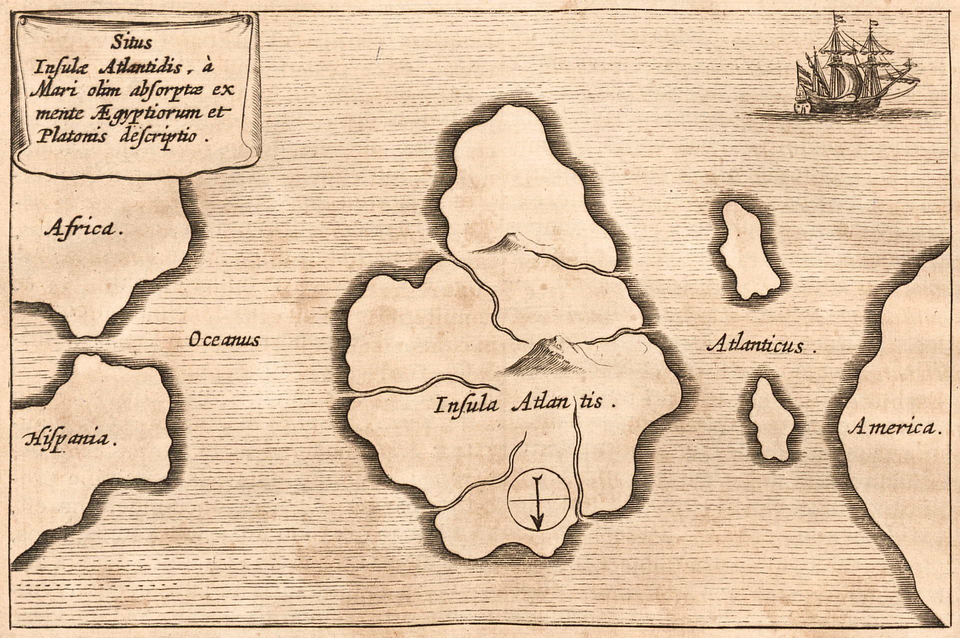
Atlantis Kircher Mundus subterraneus 1678
About This Work
The black-and-white engraving depicts a central landmass labeled 'Insula Atlantis' situated in the middle of a vast ocean. To the left, the coastlines of Spain and Africa are visible, while to the right, a portion of the American continent appears. A small sailing ship is positioned in the upper right corner, and a circular symbol featuring an arrow pointing downward is marked on the southern section of the island. The map is drawn with horizontal lines indicating water, and a title cartouche sits in the upper left corner.
This map reflects the 17th-century intellectual fascination with Plato’s dialogues 'Timaeus' and 'Critias', where the story of Atlantis originated. Kircher famously included this map in his 'Mundus Subterraneus', presenting the mythical island as a geographical reality rooted in ancient Egyptian and Platonic tradition.
Inscriptions(Latin)
Situs
Insulæ Atlantis, à
Mari olim absorptæ ex
mente Ægyptiorum et
Platonis descriptio.

Africa.

Oceanus

Hispania.

Insula Atlantis.

Atlanticus.

America.
Translation
Situation of the Island of Atlantis, once swallowed by the sea, described according to the mind of the Egyptians and Plato.